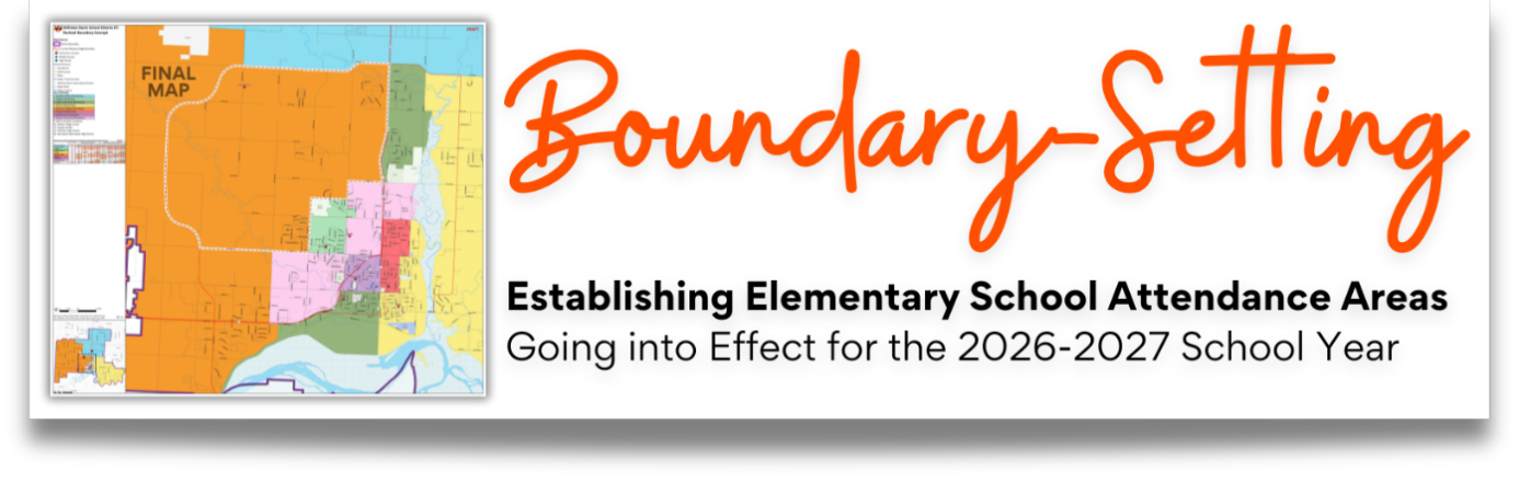
Boundary-Setting
Establishing Elementary School Attendance Areas
4/14/25 Boundary Setting Update
An interactive boundary map has been released to allow families to locate the new attendance areas according to student addresses. You can find this map below.
Regarding Transition details: While some families expressed a desire to remain in current schools, enrollment data suggests this likely isn’t workable without causing significant imbalances. A final decision will be made at the district level later this year. Community input will be considered but ultimately determined by what the data shows is possible.
4/8/25 Boundary Setting Update
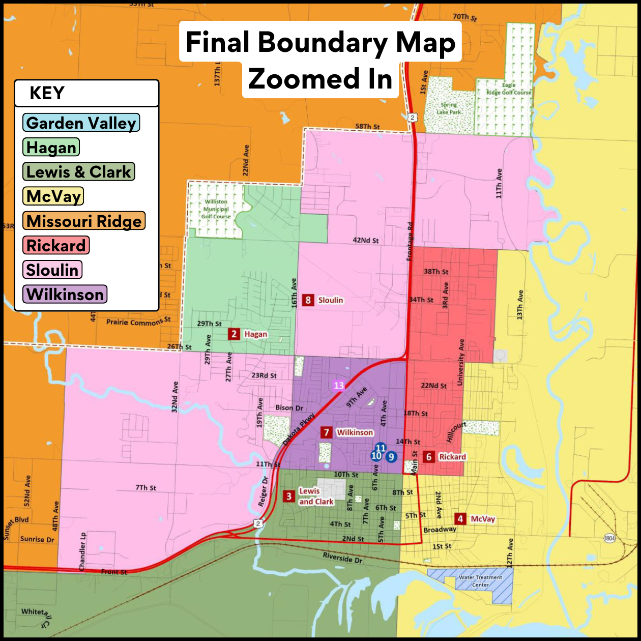
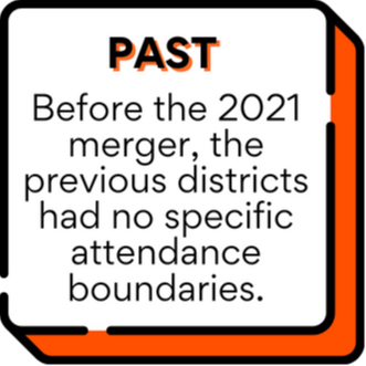
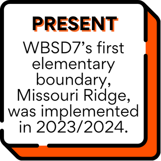
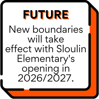
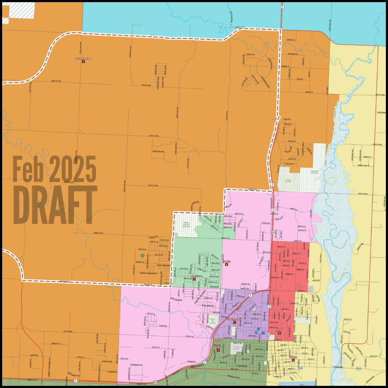
The third draft of the elementary school boundary map was approved and will be implemented in the 2026-2027 school year with the opening of Sloulin Elementary School. Transition details, including whether grandfathering will be available, will be determined later this year.
Key Points:
2025-2026 school year: No changes to current school placements.
2026-2027 school year: New boundary map goes into effect with Sloulin Elementary School opening.
April 2025: Interactive map to identify elementary school placements based on new boundaries.
Thank you for your engagement and feedback through the surveys, community meetings, and other channels over the past year. Your involvement has been crucial in shaping this process.
Interactive Boundary Map
Below is an interactive school boundaries map to be implemented in the 2026-2027 school year.
Regarding Transition details: While some families expressed a desire to remain in current schools, enrollment data suggests this likely isn’t workable without causing significant imbalances. A final decision will be made at the district level later this year. Community input will be considered but ultimately determined by what the data shows is possible.
1) To access the boundary map, open the folder below or click here to go to willistonschools.mapmyschools.com/Locator.
2) Click the "Go to Map" button.
3) Enter the student's home address and click the search button to get assigned schools.
4) Click the map to get assigned schools at any location.
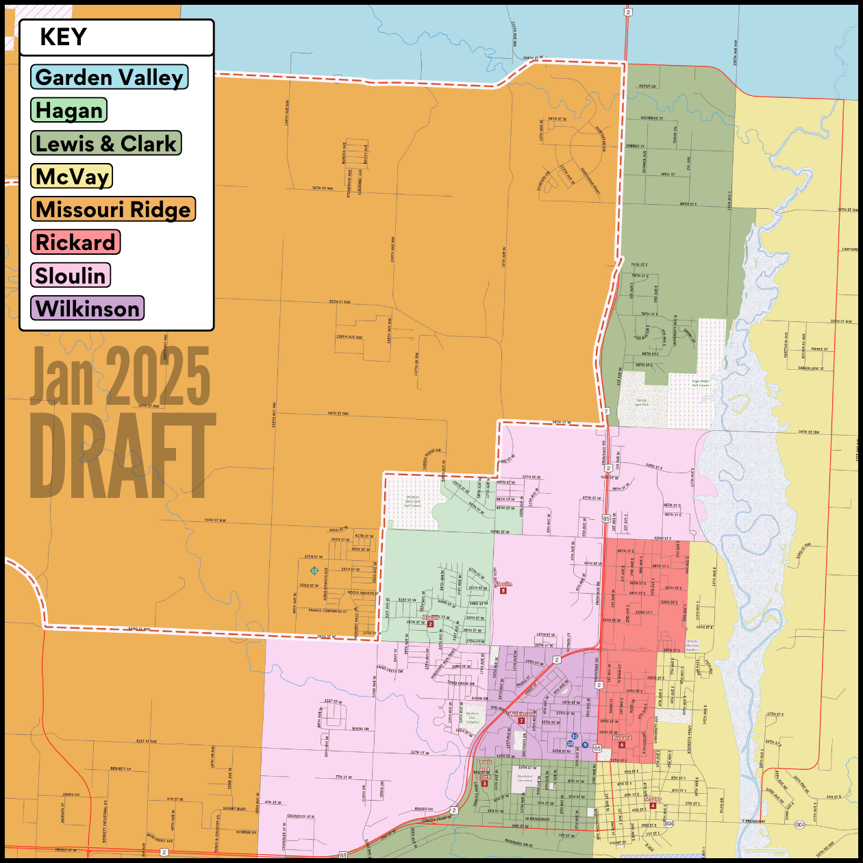
Boundary Map - FINAL DRAFT

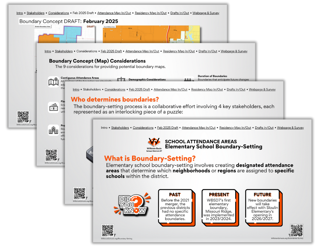
BOUNDARY SETTING OVERVIEW
What is Boundary-Setting?
Elementary school boundary-setting involves creating designated attendance areas that determine which neighborhoods or regions are assigned to specific schools within the district.
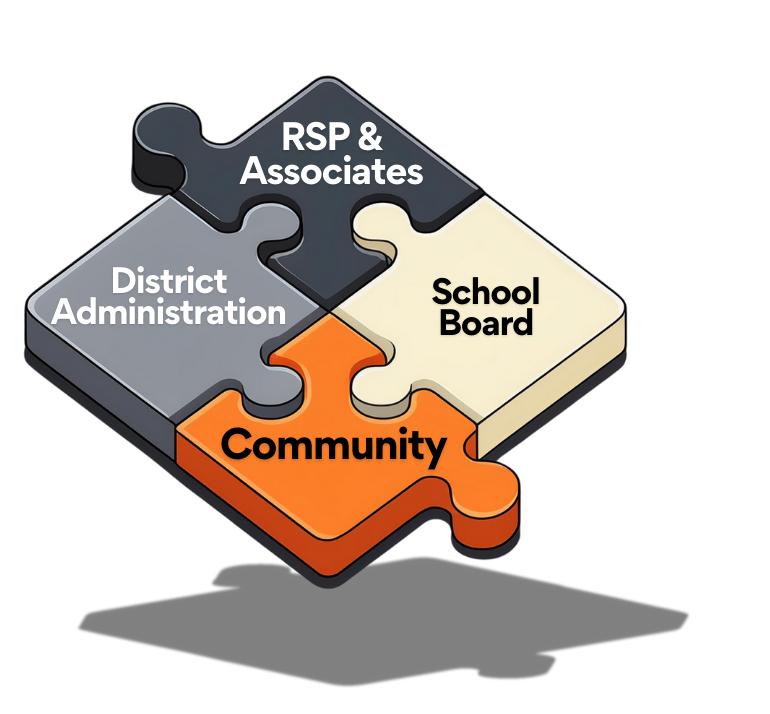
Who determines Boundaries?
The WBSD7 boundary-setting process was a collaborative effort involving 4 key stakeholders, each represented as an interlocking piece of a puzzle:
Past, Present, & Future of WBSD7 Boundaries
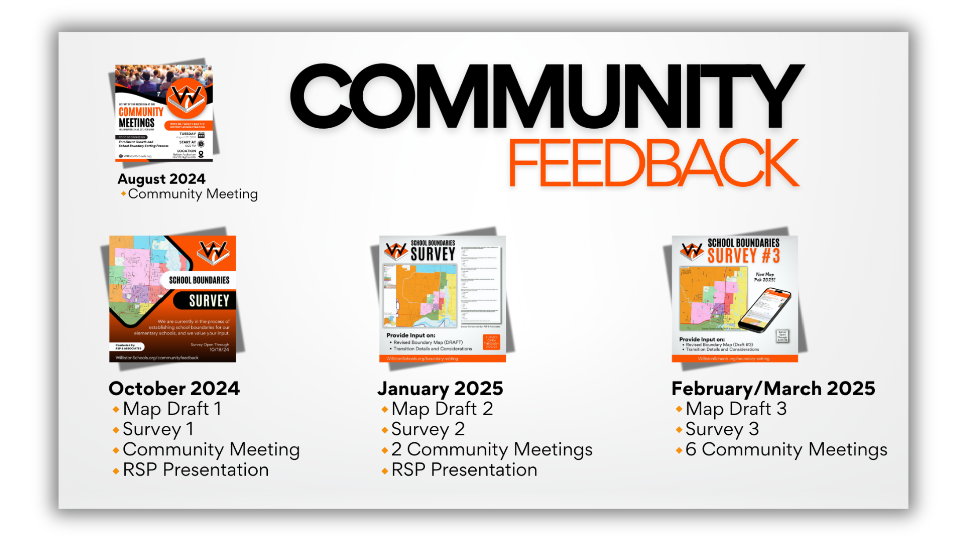
Community Feedback
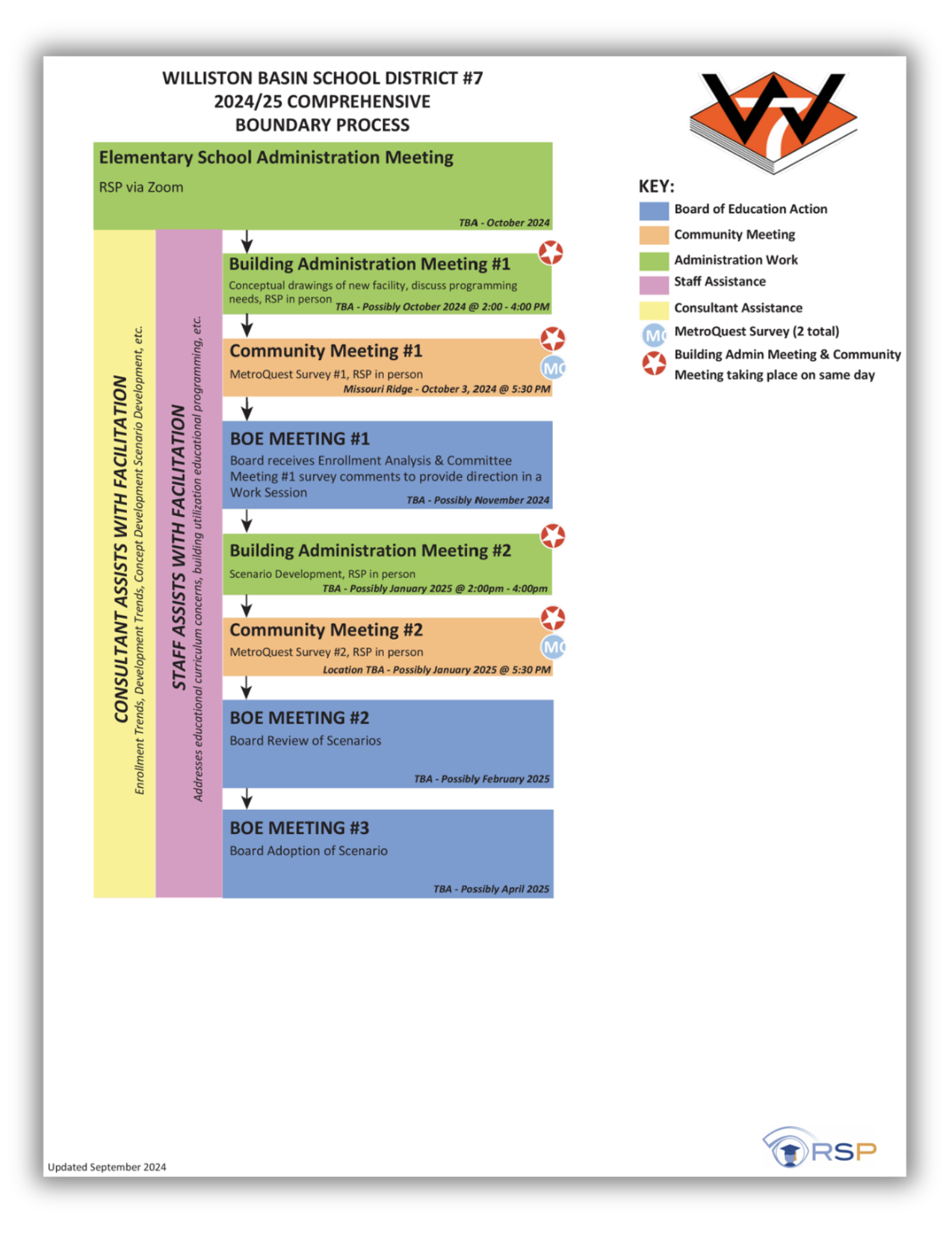
The boundary-setting process has been a collaborative effort, with community input at each stage. Here’s a timeline of key dates in the 2024/2025 school year:
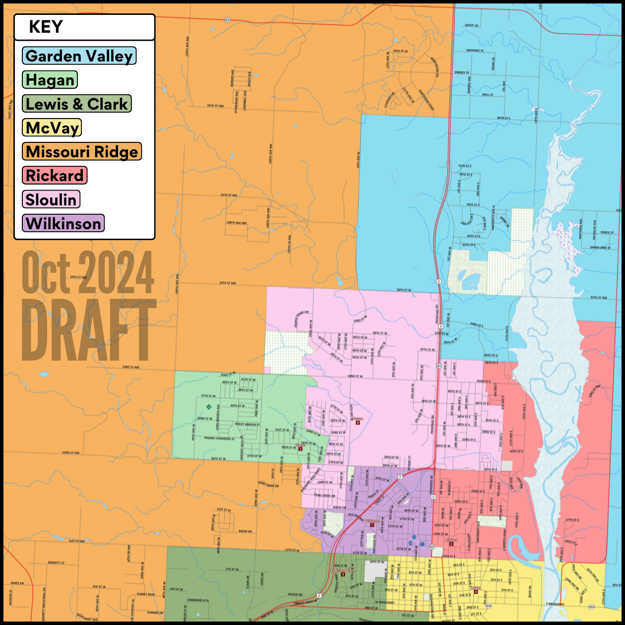
October 2024: First draft map presented with community meeting and survey.
January 2025: Second draft map shared with follow-up meeting and survey.
February/March 2025: Third draft map presented with Survey #3 for community review, along with more community meetings.
Drafts 3, 2, & 1

See below for more information.
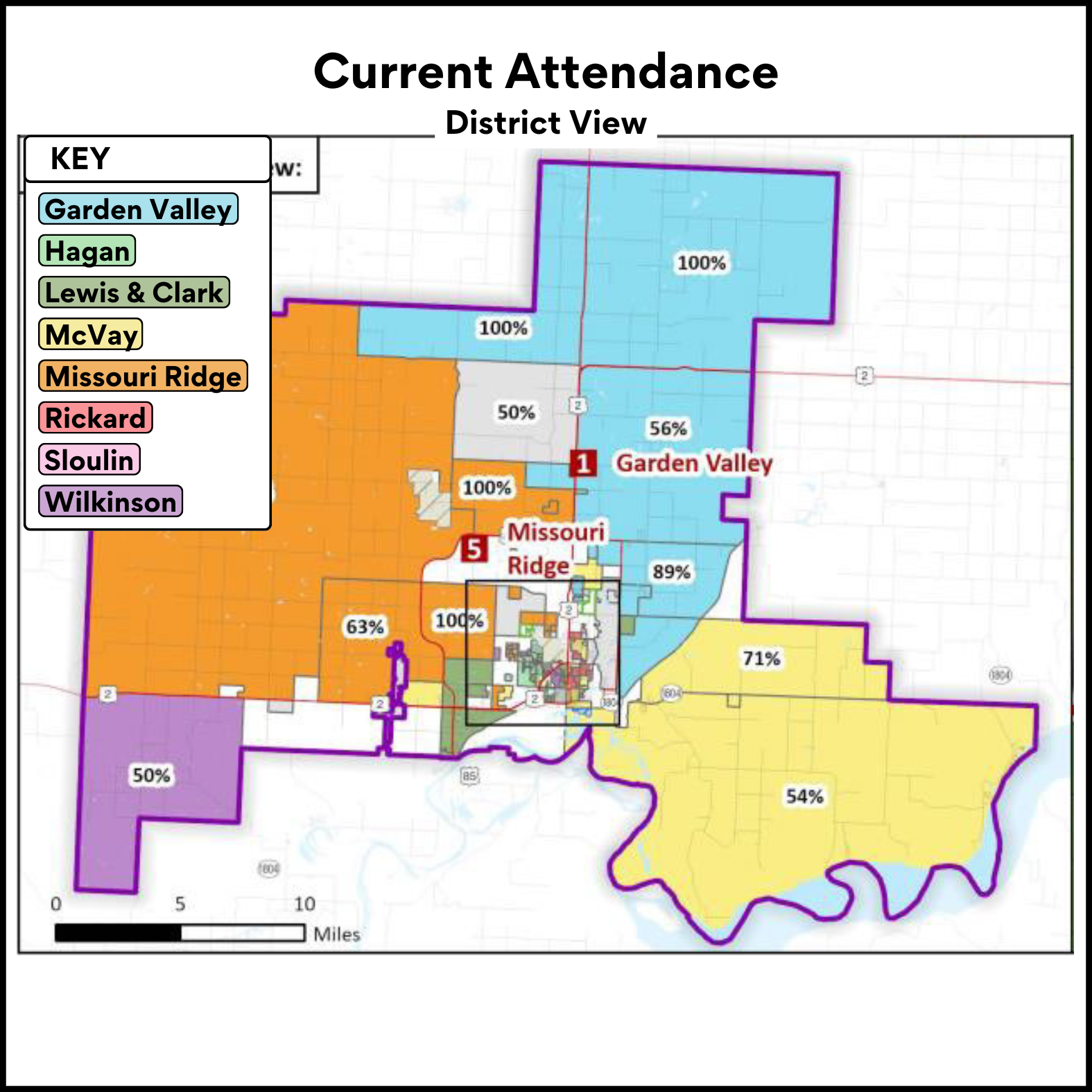
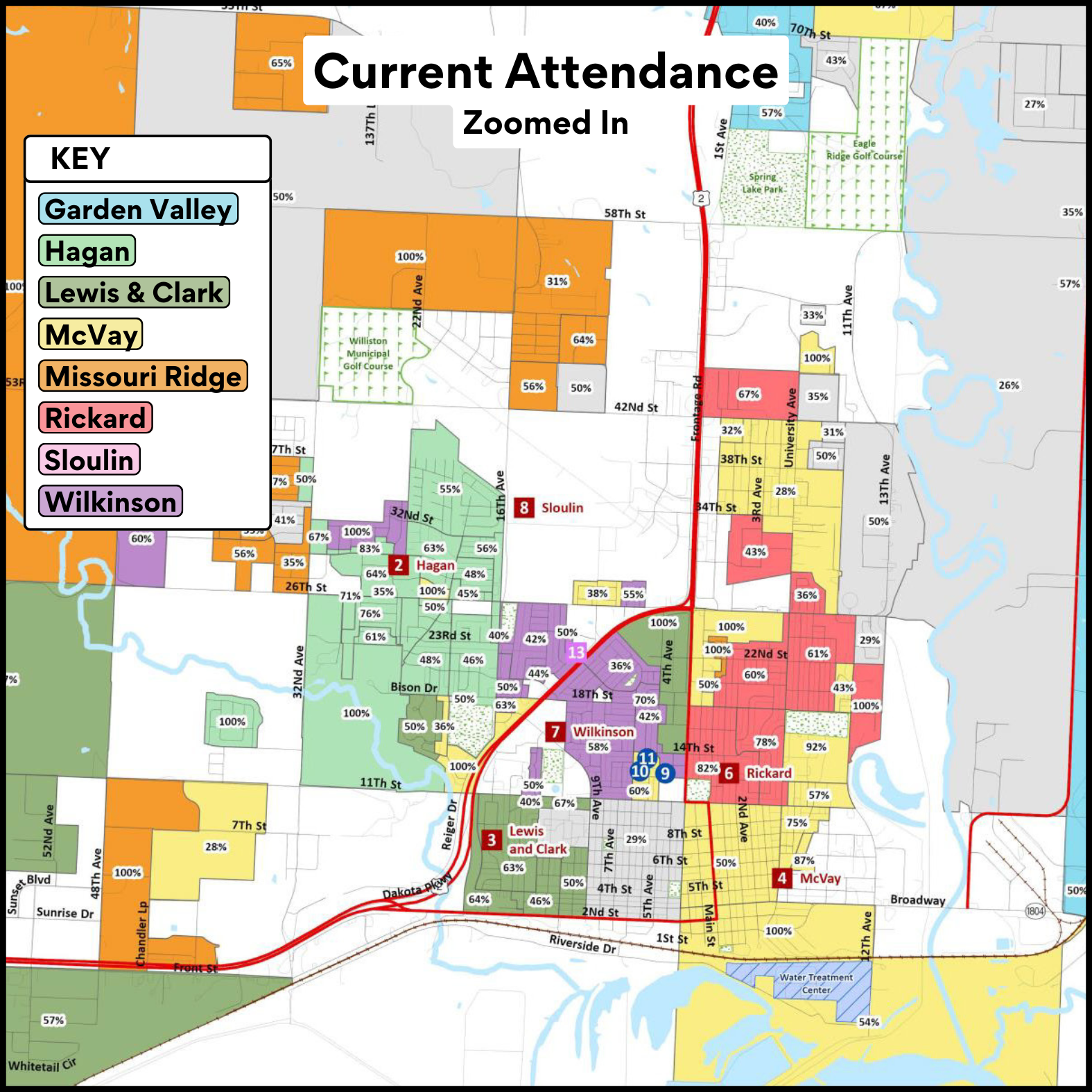
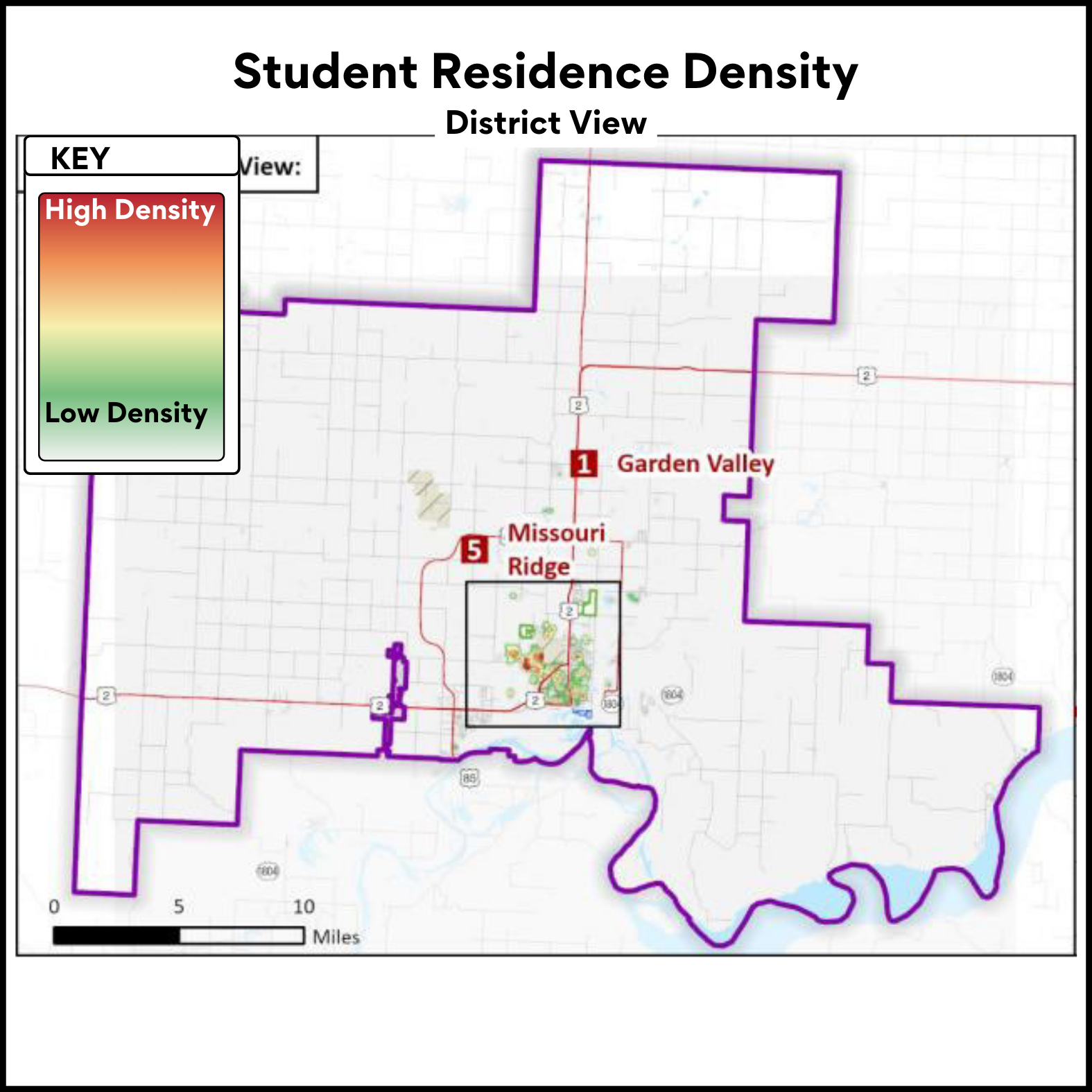
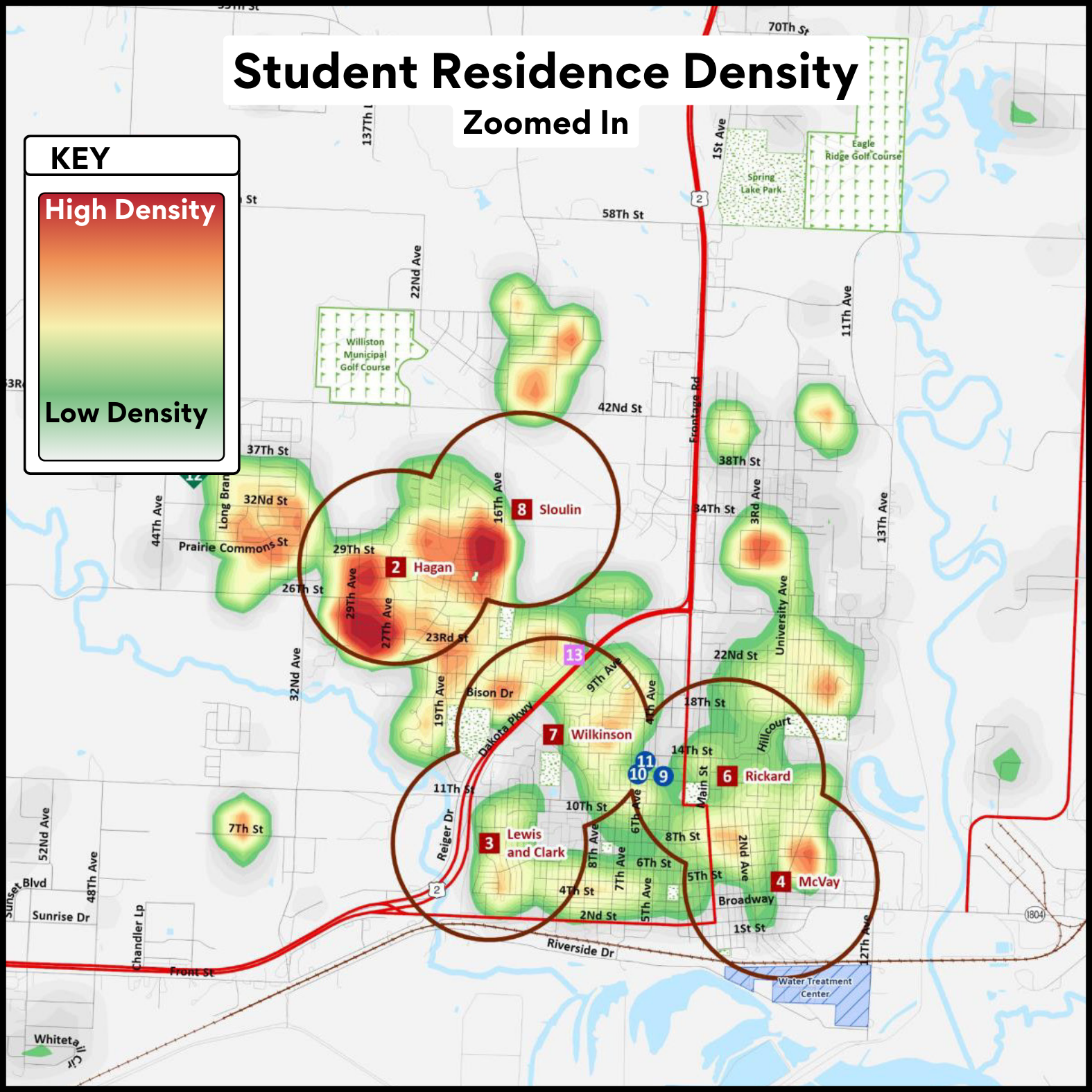
DATA MAPS
Click image to view larger map.
Final Draft
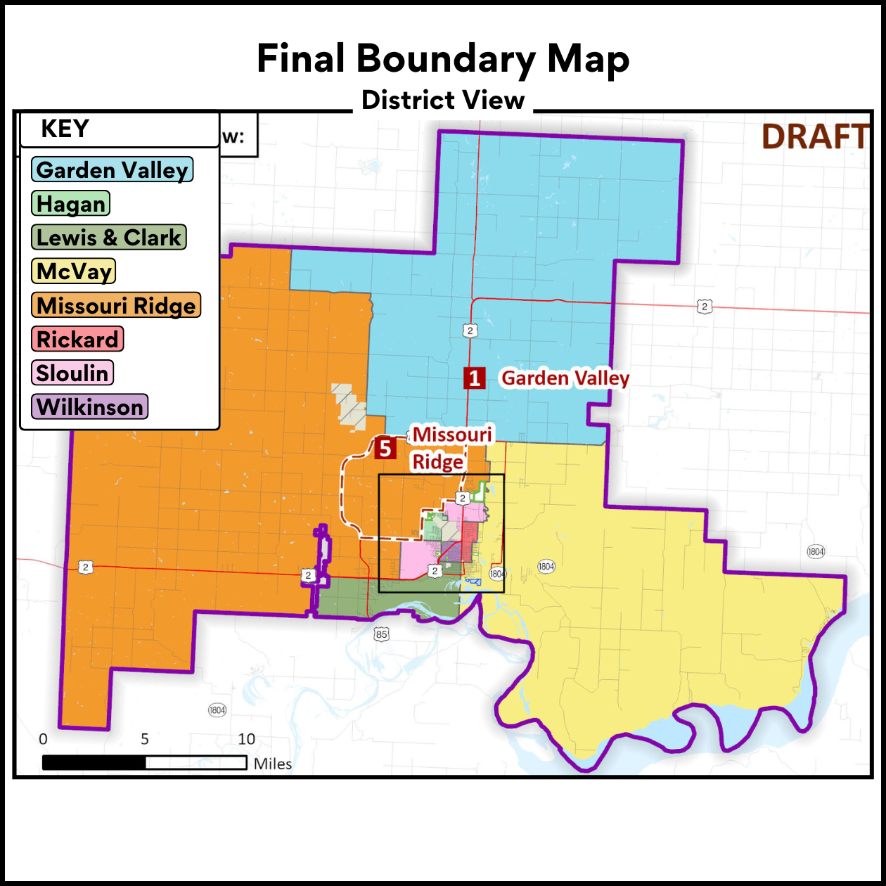

Drafts 1, 2, & 3 (final)


Attendance & Residence
PODCAST
This podcast is AI-generated and based on the contents of this webpage.
RELATED DOCUMENTS & LINKS
1.9.25 RSP Presentation - Community Meeting - Boundaries (PDF)
10.3.24 RSP Presentation - Community Meeting - Boundaries (PDF)
Video Recording, Slide Show, and Questions & Answers (PDF) from the August 2024 Community Meeting on Enrollment Growth & the Boundary-Setting process